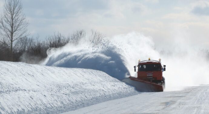
Weather warning: Blizzards happening in California
News March 22, 2024, Comments OffAcross California, especially in the Sierra Nevada mountains, a strong winter storm that brought hurricane-force winds and a ton of snowfall has caused havoc. The storm, which originated in the Gulf of Alaska, has produced blizzard conditions. CBS reporter Emily Mae Czachor states “Extremely heavy snowfall rates of 2-6 inches an hour combined with very strong winds exceeding 100 mph will maintain impossible travel conditions in the Sierra Nevada”. Travel is exceedingly perilous, if not impossible, due to wind gusts surpassing 140 mph that have devastated the highest summits of the Sierra Nevada.
Road closures and power outages are just a couple of the many interruptions caused by the heavy snowfall, which is estimated to cover portions of the mountains with six to twelve feet of snow in a matter of days. “More than 8,000 utility customers – mostly in Sierra County – were without power, according to a database maintained by USA TODAY,” USA Today reporters Christopher Cann and Dinah Voyles Pulver found. As a precaution, Yosemite National Park closed and major routes like Interstate 80 were closed for extended periods of time.
The storm provides much-needed respite for California’s water supplies despite the mayhem. The Sierra Nevada snowpack was initially falling short of seasonal averages; but recent storms have helped to its replenishment. Snowpack levels are currently approaching or perhaps surpassing the average for this time of year, which is crucial for hydropower, irrigation, and drinking water in the areas. With the considerable increase in snowpack, the April snow survey—which is critical to predicting water availability for the remainder of the year—should show this.
Significant snowfall has also been received by Sierra Nevada ski resorts due to the storm; in certain places, over 10 feet of snow has fallen. However, these resorts have had difficulties due to the harsh weather, such as facility damage from strong winds and leading to closures. When the storm began to pass, the focus turned to cleanup efforts and potential impacts from impending weather systems.
The impact of climate change on California’s snowfall patterns is still a significant concern. Research shows that precipitation patterns are changing because of rising snow lines. Hannah Fry and Rong-Gong Lin II, who are reporters for the LA Times, spoke with state climatologist Michael Anderson who said “This storm did not push us all the way to the April 1 average. The southern Sierra is still behind average for this time of year. March will remain a critical month to see how we will finish out the season. We may still need some additional storms to boost our snowpack above average by April 1 and improve our chances of having average runoff into our reservoirs”. Although the strongest storms may produce more snowfall, there is an overall pattern leaning toward fewer snowy days. Warmer storms produce more snow, which makes managing the region’s water resources increasingly difficult.
This strong winter storm has presented challenges, but it also serves as a reminder of the need to be ready and resilient when dealing with severe weather. Efforts to adapt and lessen the consequences of climate change are still essential for California’s long-term sustainability and resilience as the state struggles with its repercussions.